US-India Satellite Captures Time-lapse Video of Volcanic Eruption
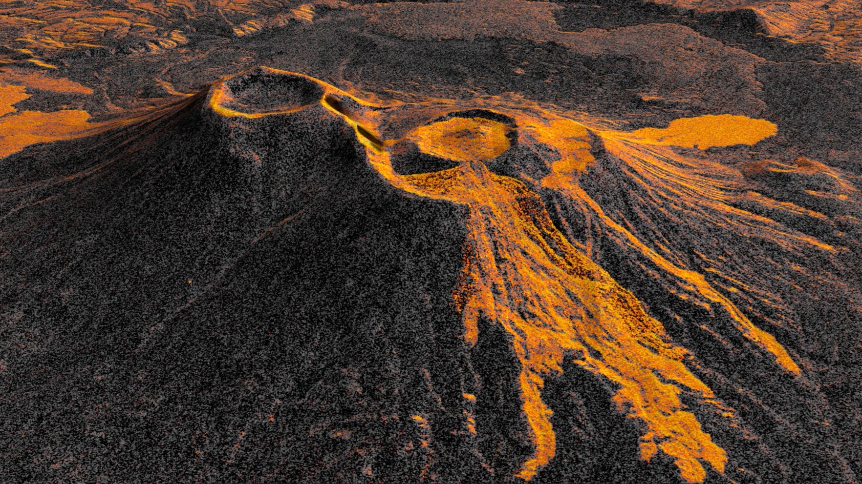
Like tendrils on a vine, lava spreads out from the northern crater of Krasheninnikov, a volcano pair on the Pacific coast of Russia’s Kamchatka Peninsula. On July 30, 2025, an 8.8-magnitude earthquake had struck in the nearby ocean, apparently jolting one of the two volcanoes awake. A few days later, for the first time in […]
Where: India, California, United States, Russia, Alaska
Exact coordinates
india: 20.590, 78.960
california: 36.780, -119.420
united states: 37.090, -95.710
russia: 61.520, 105.320
alaska: 64.200, -152.490
Read it at NASA See this on the map
What might happen next? AI-generated
These scenarios are written by an AI language model from the headline and summary above. They are not predictions from the newsroom, and they are not evidence of anything. Every one is given a deadline and checked against later coverage, and the score is published on the ledger — including the ones that miss.
-
Awaiting deadline 50% Immediate Scientific Focus
The international scientific community dominates the narrative as NASA and global seismology teams release a coordinated joint statement analyzing the geological data from the satellite imagery. Focus remains strictly on monitoring the eruption's progression and seismic aftershocks. The geopolitical implications remain purely academic until further physical evidence surfaces.
Watch for: NASA releases a 300-page technical report on the eruption's subsurface dynamics · A joint press conference is held by the USGS and Russian scientific institutes regarding the Kamchatka eruption
-
Awaiting deadline 25% Localized Evacuation
Based on the satellite imagery indicating lava spread, local Russian authorities issue an official evacuation order for villages within a 10-kilometer radius of the active crater. Emergency services mobilize, and temporary shelters are established by local government within the 7-day window. The international scientific interest remains high, but the focus shifts to humanitarian aid logistics.
Watch for: Russian Ministry of Emergency Situations confirms mass evacuation orders for specific districts near the volcano · Local municipal leaders announce the distribution of emergency supplies to evacuees
-
Awaiting deadline 15% Counter-Intuitive International Intervention (Low Probability)
Despite the purely natural nature of the event, the eruption triggers heightened geopolitical tensions. A non-aligned nation uses the perceived instability as a pretext to increase naval patrols near the Russian Pacific coast. This diplomatic action, seemingly unrelated to geology, causes friction with the Russian Foreign Ministry, leading to a public protest at a UN Security Council session.
Watch for: A named foreign naval vessel is reported entering a 'restricted zone' near the Kamchatka Peninsula · The Russian Ministry of Foreign Affairs issues a strongly worded diplomatic protest at the UN
-
Awaiting deadline 10% Rapid Containment/Monitoring Protocol
A pre-existing, high-level international disaster monitoring pact is activated, perhaps triggered by the magnitude of the earthquake or the eruption's scale. A specialized, multinational geological monitoring team is granted temporary access to the affected zone by Russian authorities. The primary short-term outcome is the installation of advanced, ground-based monitoring sensors.
Watch for: A consortium of international geological survey firms is announced as having begun site surveys in Kamchatka · The Russian government grants temporary, monitored access permissions to foreign technical experts
Generated by llama
on 2026-09-24. Checked against later coverage after 2026-09-27.
See how these forecasts score.
ForecastGeo shows the headline and summary published by the newsroom and places the story on a map. The full article lives at the source.