Tropical Storm Polo will impact the U.S. after slamming Mexico. See its path.
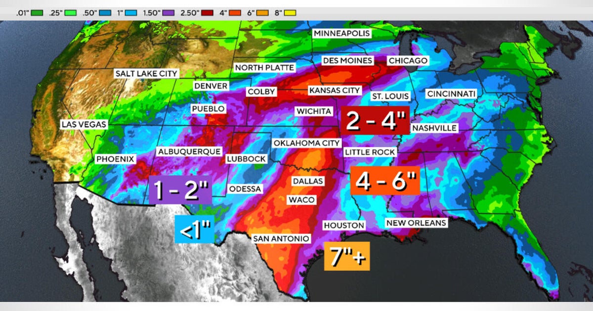
Former Hurricane Polo, now a tropical storm, is expected to bring heavy rain and flooding to parts of the southwestern United States.
Where: Hawaii, Mexico, Texas, Arizona, New Mexico, California, United States, Colorado, Iowa
Exact coordinates
hawaii: 19.900, -155.580
mexico: 23.630, -102.550
texas: 31.970, -99.900
arizona: 34.050, -111.090
new mexico: 34.520, -105.870
california: 36.780, -119.420
united states: 37.090, -95.710
colorado: 39.550, -105.780
iowa: 41.880, -93.100
Read it at CBS News See this on the map
What might happen next? AI-generated
These scenarios are written by an AI language model from the headline and summary above. They are not predictions from the newsroom, and they are not evidence of anything. Every one is given a deadline and checked against later coverage, and the score is published on the ledger — including the ones that miss.
-
Awaiting deadline 45% Standard Impact & Recovery
The storm makes its predicted landfall in the U.S. Southwest, causing moderate flooding as anticipated. Emergency services in affected counties activate, and local governments issue mandatory evacuation notices for the most vulnerable areas.
Watch for: Local emergency management agencies issue a formal 'all clear' statement following the storm's passage. · U.S. Department of Weather and Climate News reports localized flood damage assessments for the Southwest.
-
Awaiting deadline 25% Severe Flooding & Infrastructure Failure
Tropical Storm Polo intensifies beyond its current forecast due to anomalous moisture levels, leading to flash flooding in previously unaffected low-lying areas. Key infrastructure, such as a specific highway interchange, experiences significant damage requiring major state intervention.
Watch for: State transportation department issues an emergency directive closing a major regional highway due to washout. · Local news outlets broadcast emergency broadcasts detailing structural damage to a bridge or levee.
-
Awaiting deadline 20% Rapid Dissipation & Minimal Impact
The storm moves faster than anticipated and weakens significantly upon reaching the U.S. boundary, resulting in a quick pass with only heavy rain in non-flood-prone areas. Insurance claims are minimal, and public attention quickly shifts to the next weather system.
Watch for: Meteorological agency issues a bulletin stating Tropical Storm Polo has downgraded to a tropical depression or remnant low while still over land. · Local utility companies report only minor, non-disruptive power fluctuations following the event.
-
Awaiting deadline 10% Counter-Intuitive Regional Surge (The 'Anomalous Trajectory')
Against the general flow of weather prediction, the storm takes an unexpected northward or eastward turn due to a sudden, unpredicted shift in the jet stream. This pushes the heaviest bands into a more populated, high-density metro area than initially forecast.
Watch for: A specific, major metropolitan area outside the initial forecast zone issues an emergency alert regarding heavy precipitation. · National weather service issues a special advisory regarding a previously unmodeled track for Tropical Storm Polo.
Generated by llama
on 2026-09-29. Checked against later coverage after 2026-10-13.
See how these forecasts score.
ForecastGeo shows the headline and summary published by the newsroom and places the story on a map. The full article lives at the source.