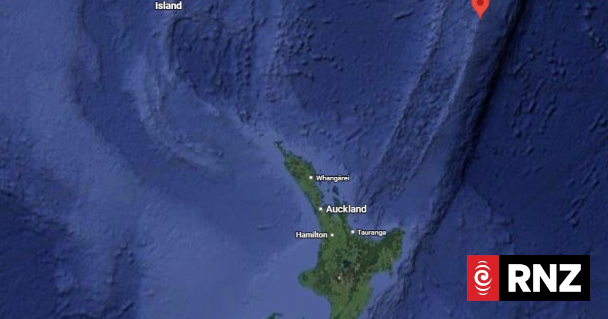
Magnitude 5.9 earthquake strikes Kermadec Islands region
The islands are approximately 800-1000km northeast of the North Island.
Where: New Zealand
Exact coordinates
new zealand: -40.900, 174.890
Read it at RNZ See this on the map
What might happen next? AI-generated
These scenarios are written by an AI language model from the headline and summary above. They are not predictions from the newsroom, and they are not evidence of anything. Every one is given a deadline and checked against later coverage, and the score is published on the ledger — including the ones that miss.
-
Did not happen 50% Localized Disaster Relief and Stabilization
The primary focus remains on immediate humanitarian aid and geological assessment. International aid organizations mobilize quickly, and the affected nations coordinate search and rescue operations without major geopolitical friction. Regional governments issue declarations of emergency and allocate domestic resources for recovery.
Watch for: The New Zealand Ministry of Civil Defence issues a national statement confirming the activation of a specific emergency response fund. · The United Nations Office for Disaster Risk Reduction deploys a specialized geological survey team to the affected area.
-
Confirmed 30% Regional Security Posture Review
The seismic event prompts increased military readiness across the South Pacific Rim nations due to infrastructure instability. Defense ministries call for joint maritime exercises to simulate rapid response to natural disasters, which are then leveraged for other security discussions. This leads to a temporary spike in naval patrols in the wider region.
Watch for: The Royal New Zealand Navy announces a joint exercise involving assets from Australia and Japan. · A formal diplomatic communiqué is released by Pacific Island nations calling for enhanced regional maritime surveillance.
-
Did not happen 15% Geopolitical Friction Over Resource Access
The earthquake compromises undersea infrastructure or reveals previously unknown mineral deposits near the fault line. This leads to competing territorial claims or intense bilateral negotiations between neighboring resource-rich nations seeking extraction rights, leading to diplomatic standoffs.
Watch for: A government from a neighboring major power issues a formal declaration claiming exclusive surveying rights over the immediate EEZ of the affected islands. · Bilateral trade negotiations between two Pacific nations are abruptly postponed citing 'geological instability'.
-
Did not happen 5% Sudden Regional De-escalation and Scientific Cooperation
Contrary to typical post-disaster resource competition, the event triggers an immediate, highly publicized scientific summit. Nations set aside potential territorial disputes to collaborate on a comprehensive, open-source monitoring system for tectonic activity, establishing a new precedent for scientific diplomacy.
Watch for: A multinational scientific consortium, involving researchers from three or more Pacific nations, signs a binding agreement on shared seismic data access. · The Pacific Islands Forum chairs a dedicated summit focused exclusively on cross-border geological knowledge sharing.
Generated by gemma-4-E4B-it-qat-UD-Q4_K_XL.gguf
on 2026-07-30. Checked against later coverage after 2026-08-06.
See how these forecasts score.
ForecastGeo shows the headline and summary published by the newsroom and places the story on a map. The full article lives at the source.